 Chizroid

Japanese topographical map viewer
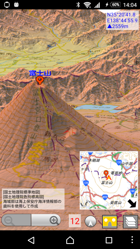
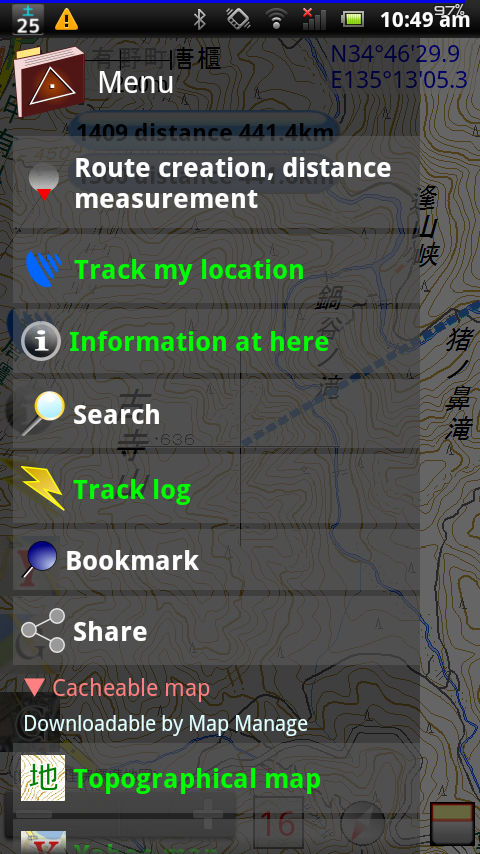
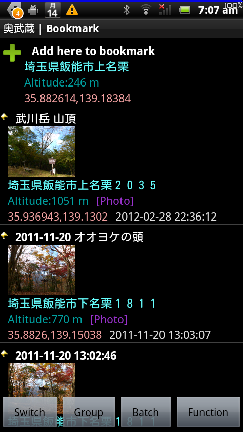
Japanese topographical map viewer for Android.If you want to see other country, please select OpenStreetMap at Menu -> Map Manage ->Map ModeWe use the tile according to the rules of Geospatial Information Authority of Japan.Functions-Topographical map (Japan only. Tile of Geospatial Information Authority of Japan.)-OpenStreetMap-Web map tile-GPS location search-Bookmark (You can record POI)-Distance measurement-Route creation (route of straight line, route)-Import GPX file (Please send GPX file from file manager application)Icons by Orion Icon Library - https://orioniconlibrary.comSmart Connect extension for SmartWatch 2Version 17.14 (2022/4/17)-Added the shortcut function for Web Map Tile.-Improvements and bug fixes.Version 17.13 (2022/3/27)-Improved the track log player function of 3D and VR.-Improvements and bug fixes.Version 17.12 (2022/1/10)-Greatly enhanced line-of-sight operation at VR function.-Bug fixes.
Japanese topographical map viewer for Android.If you want to see other country, please select OpenStreetMap at Menu -> Map Manage ->Map ModeWe use the tile according to the rules of Geospatial Information Authority of Japan.Functions-Topographical map (Japan only. Tile of Geospatial Information Authority of Japan.)-OpenStreetMap-Web map tile-GPS location search-Bookmark (You can record POI)-Distance measurement-Route creation (route of straight line, route)-Import GPX file (Please send GPX file from file manager application)Icons by Orion Icon Library - https://orioniconlibrary.comSmart Connect extension for SmartWatch 2Version 17.14 (2022/4/17)-Added the shortcut function for Web Map Tile.-Improvements and bug fixes.Version 17.13 (2022/3/27)-Improved the track log player function of 3D and VR.-Improvements and bug fixes.Version 17.12 (2022/1/10)-Greatly enhanced line-of-sight operation at VR function.-Bug fixes.
Read trusted reviews from application customers
高低差がわかる地図は希少、メモリーも少なくて大丈夫
18MB Update
works perfect. great app! thanks for feedback. 1st app i installed on this device
A very useful program to view GPX files. Setting the default map to Google showed better street and road details, but suffers from Google's policy of not showing commercial establishment's names when they have not paid. The display shows four useful parameters on one screen. These are 1- Location on map 2- Distance from origin 3- Time and date * 4- Elevation (altitude) * Unfortunately time and date are displayed relative to current position and not the coordinates of the map. ** Better than MyTracks
au C01にて使用していますが、軽快で安定した動作に満足しています!
Nice browser for GSI map. I love this!